Map
Map uses the Map coordinates in location cards and an optional background image to display story space.
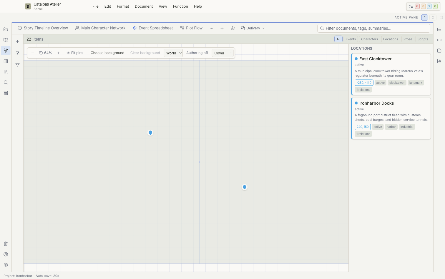
Coordinate modes
- World: abstract coordinates for a fictional space.
- Image: positions relative to a background image, suitable for a building, campus, or fantasy continent.
- Geo: geographic coordinates for real-world locations.
Changing the coordinate mode changes what existing coordinate values mean. Confirm that the new mode matches the existing data before saving it.
Background and viewport
Choose or clear a background, select Cover, Contain, or Stretch, and use zoom, Reset map view, or Fit pins. A background is a Project asset, not an online map service.
Authoring
Turn authoring on to create a location at a selected position, move pins, or open a location for editing.
Deletion warning
Deleting the current location record from Map may move its location file to Trash; it does not simply remove a pin from the screen. If you only want to hide a location, change the filter or saved view instead.
For a complete location workflow, see Build characters, locations, and a story world.